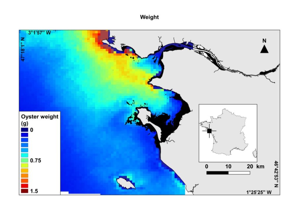
In the frame of the H2020 TAPAS project, Université de Nantes developed a GIS tool based on Earth Observation and shellfish ecophysiological modeling for oyster-farming site selection. The satellite-derived, high-resolution maps of seawater temperature, turbidity and phytoplankton (a proxy of available food for oyster) have been coupled with oyster biological modeling to create predictive maps of oyster growth rate in off-shore waters where shellfish farming does not currently take place. This tool will allow farmers to identify the offshore sites with the highest farming potential, and environmental managers to improve spatial planning. Due to the on-going over-exploitation of marine resources and the limited space available for human activities in coastal areas, moving offshore is an emerging approach in many economical domains, including shellfish farming. While many current and near-future projects invest in expensive and high-tech solutions, small companies such as family-run oyster farming business could also benefit from the offshore “gold rush”.